America’s Challenge Tracking Maps

  1. Home
  2. Experience the Fiesta
  3. America’s Challenge
  4. America’s Challenge Tracking Maps

America’s Challenge began in 1995.

For the first few years, position reports were embargoed for hours in order to not give any team a competitive advantage. Over the years, due partly to the advances in tracking technology, we have been able to track the progress of our competitors in real-time. Below are the final tracking maps from the most recent events. Click on an image to take a closer look.
Map Placeholder - No Event This Year

2020 Event Postponed due to Covid

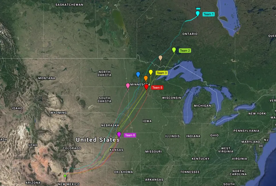
2019 Tracks - Map with series of paths starting in Albuquerque and heading northeast to endpoints mostly in Minnesota and Ontario

2019 Tracks

Map Placeholder - No Event This Year

No 2018 Event due to proximity of Gordon Bennett Event

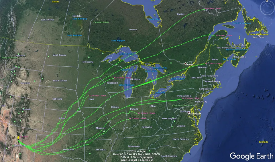
2017 Tracks - Map with series of paths starting in Albuquerque and heading east to endpoints as far north as the northeast border of Quebec and as far south as Indiana

2017 Tracks

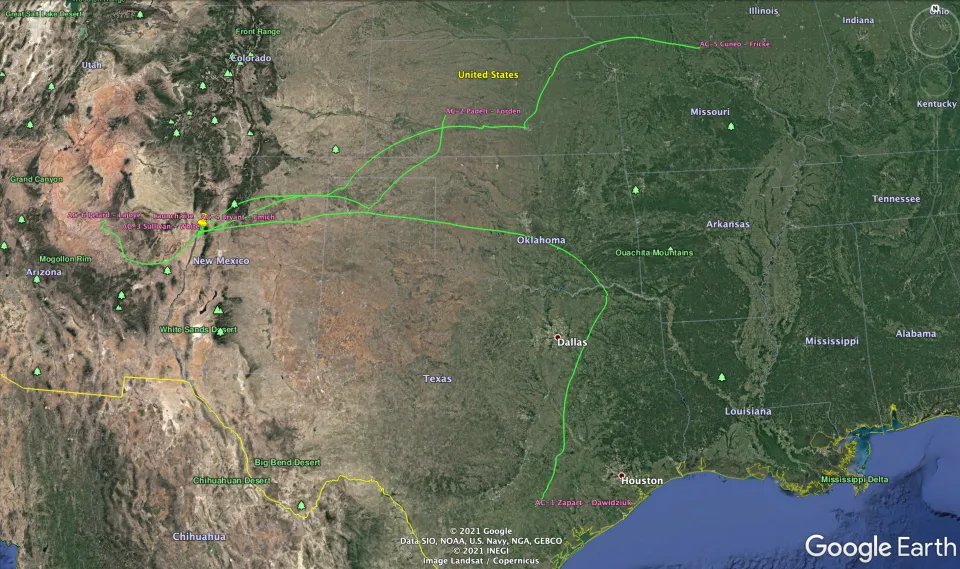
2016 Tracks - Map with series of paths starting in Albuquerque and heading either east to endpoints in Kansas and Missouri or south to Texas

2016 Tracks

Map Placeholder - No Event This Year

2015 – No flights due to weather

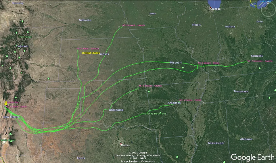
2014 Tracks - Map with series of paths starting in Albuquerque and heading to endpoints across the midwest

2014 Tracks

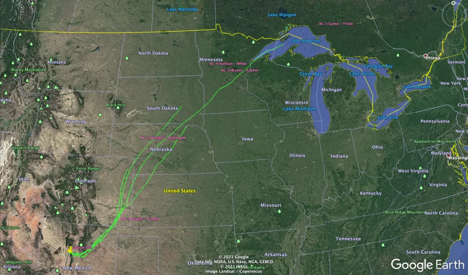
2013 Tracks - Map with series of paths starting in Albuquerque and heading northeast towards Lake Superior

2013 Tracks

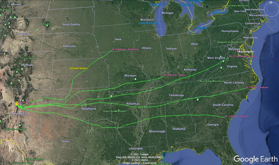
2012 Tracks - Map with series of paths starting in Albuquerque and heading east to endpoints in Iowa, Kentucky and along the east coast in Virginia, North and South Carolina

2012 Tracks

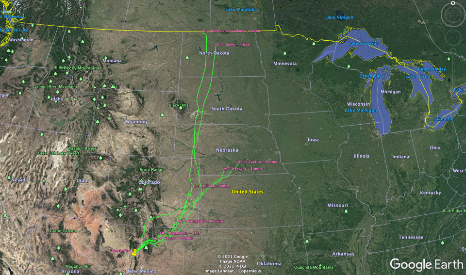
2011 Tracks - Map with series of paths starting in Albuquerque and heading east and then north through Nebraska, South and North Dakota

2011 Tracks

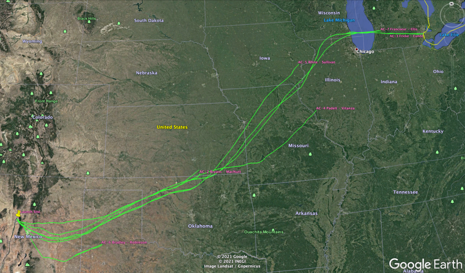
2010 Tracks - Map with series of paths starting in Albuquerque and heading east and then north to the great lakes area

2010 Tracks

Map Placeholder - No Event This Year

2009 – No flights due to weather